

Public access
Venetian Causeway
What to notice
Cross the historic causeway on foot or by bicycle to read the relationship between the islands, Biscayne Bay, Miami and Miami Beach.
Learn moreInformation from: Miami-Dade County
Area guide · Miami-Dade
A chain of residential islands between Miami and Miami Beach, where lot orientation, bridge access, elevation and renovation scope are central to due diligence.
The area in context
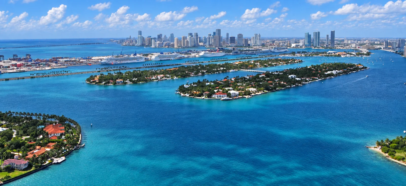
The Venetian Islands are a chain of man-made residential islands laid out during Miami's 1920s development era and connected by the Venetian Causeway. Biscayne Island, San Marco, San Marino, Di Lido and Rivo Alto are individually named islands along the route, with Belle Isle at the Miami Beach end. The causeway entered the National Register of Historic Places in 1989. Their position between the mainland and Miami Beach creates changing bay views, bridge relationships and access patterns from island to island.
The architecture ranges from restored mid-century houses to contemporary waterfront construction, with a limited number of multifamily buildings around Belle Isle. The causeway supports walking and cycling connections, while dining, parks and cultural destinations sit primarily at either end; elevation, seawall condition, lot orientation and renovation history remain property-specific questions.
Each named island has its own character. Their creation belonged to the same 1920s development wave associated with Carl Fisher and John Collins, and the Venetian Causeway was the original roadway of that era between Miami and Miami Beach. Pedestrians and cyclists cross the causeway toll-free.
Area guide
The best way to understand the area is to move through it with attention: notice how the landscape changes, how the architecture meets the street and how parks, culture and transportation connect each stop.
The most revealing route is the Venetian Causeway itself. Moving between Miami and Miami Beach shows how each island changes in parcel size, street pattern, bridge exposure and relationship to Biscayne Bay. Belle Isle adds a public green space at the eastern end, while nearby Sunset Harbour brings dining and daily services into the picture. The result is a chain of small submarkets, not one interchangeable waterfront address.
The causeway is the experience. Crossing from Miami toward Miami Beach reveals the bay in successive frames: bridges, small islands, waterfront lots and changing skyline views. Belle Isle offers the clearest public pause near the eastern end; from there, Sunset Harbour adds dining and services before the route continues into the larger Miami Beach network.
Venetian Causeway • Belle Isle Park • Sunset Harbour
Plan the visit in sections: these landmarks do not necessarily form one continuous walk. Check travel between them on a map and confirm transport, parking and access hours before setting out.
What to notice
Cross the historic causeway on foot or by bicycle to read the relationship between the islands, Biscayne Bay, Miami and Miami Beach.
Learn moreInformation from: Miami-Dade County
What to notice
Pause at the public green space on Belle Isle and observe how park access, bridge traffic and bay frontage shape this end of the chain.
Learn moreInformation from: City of Miami Beach
What to notice
Extend the route to nearby Sunset Harbour for dining and services, then connect with Miami Beach's wider park and beach network.
Learn moreInformation from: City of Miami Beach
Current residential listings for sale matching the search below, from the MIAMI Association of REALTORS® MLS, delivered through Bridge.
Feed search scope: Text search: Venetian Islands. Matches listing fields; not an official neighborhood boundary.
View listingsThe live feed did not return a reliable result for this search. Open the property search to review current results or adjust the filters.
Reading the area
Island ownership puts extra weight on access, waterfront orientation, elevation, parcel or association rules and the practical route back to the mainland.
Access, hours, fees and programming can change. Use the linked source before planning a visit.
Price range, area and exact location change the comparison. Talk with Flavia to identify the submarkets and properties that fit your purchase plan.
Schedule a consultation